Historic Maps
1895 Fire Insurance Maps of Kansas City - Volume Three
Published by the Sanborn Perris Map Co., 115 Broadway, New York — Founded in 1867 by D. A. Sanborn, the Sanborn Map Company was the primary American publisher of fire insurance maps for nearly 100 years. The maps were created to allow fire insurance companies to assess their total liability in urbanized areas for the Unites States. The Sanborn maps themselves are large-scale lithographed street plans at a scale of 50 feet to one inch (1:600) on 21 by 25 inches (53 by 64 cm) sheets of paper. The maps were published in volumes, bound and then updated until the subsequent volume was produced. The maps include outlines of each building and outbuilding; the location of windows and doors; street names; street and sidewalk widths; property boundaries; fire walls; natural features (rivers, canals, etc.); railroad corridors; building use (sometimes even particular room uses); house and block number; as well as the composition of building materials including the framing, flooring, and roofing materials; the strength of the local fire department; indications of sprinkler systems; locations of fire hydrants; location of water and gas mains; and even the names of most public buildings, churches and businesses.
Source: ProQuest Digital Sanborn Maps, 1867-1970 via Mid-Continent Public Library.
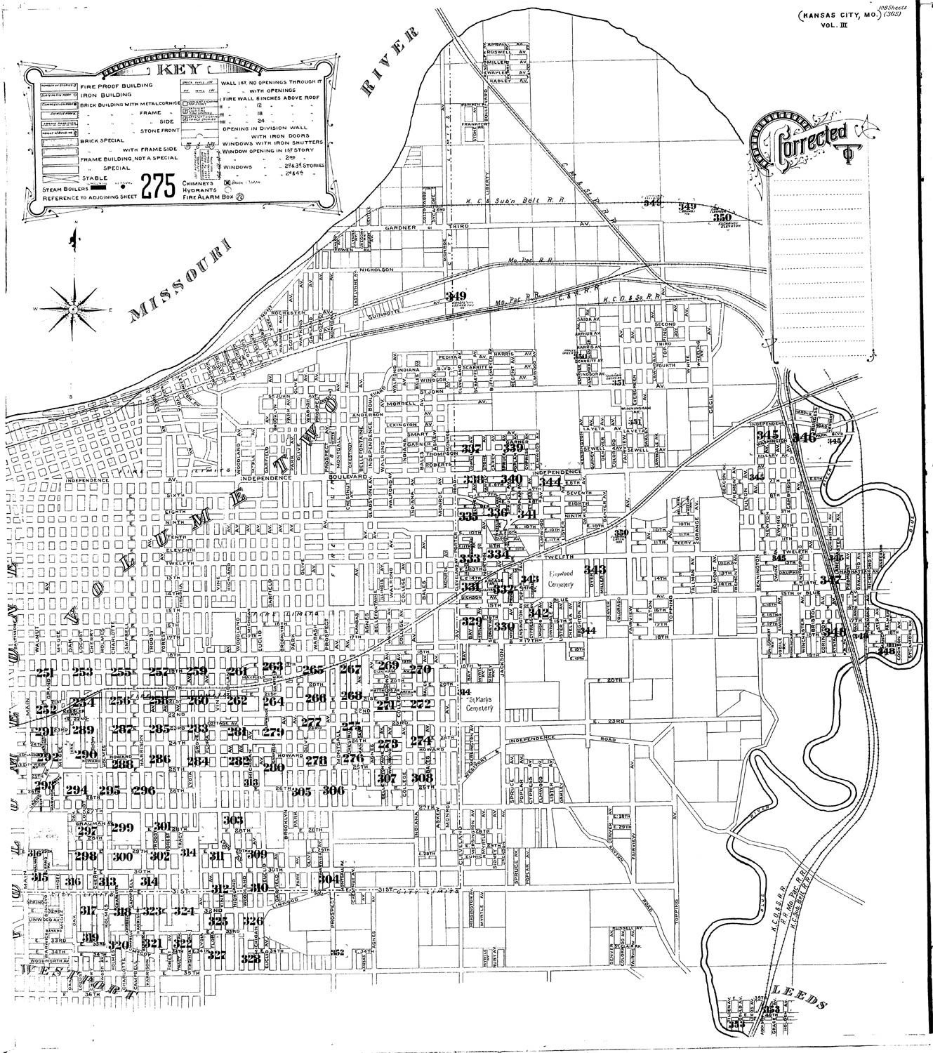
1896 Sanborn Key Map
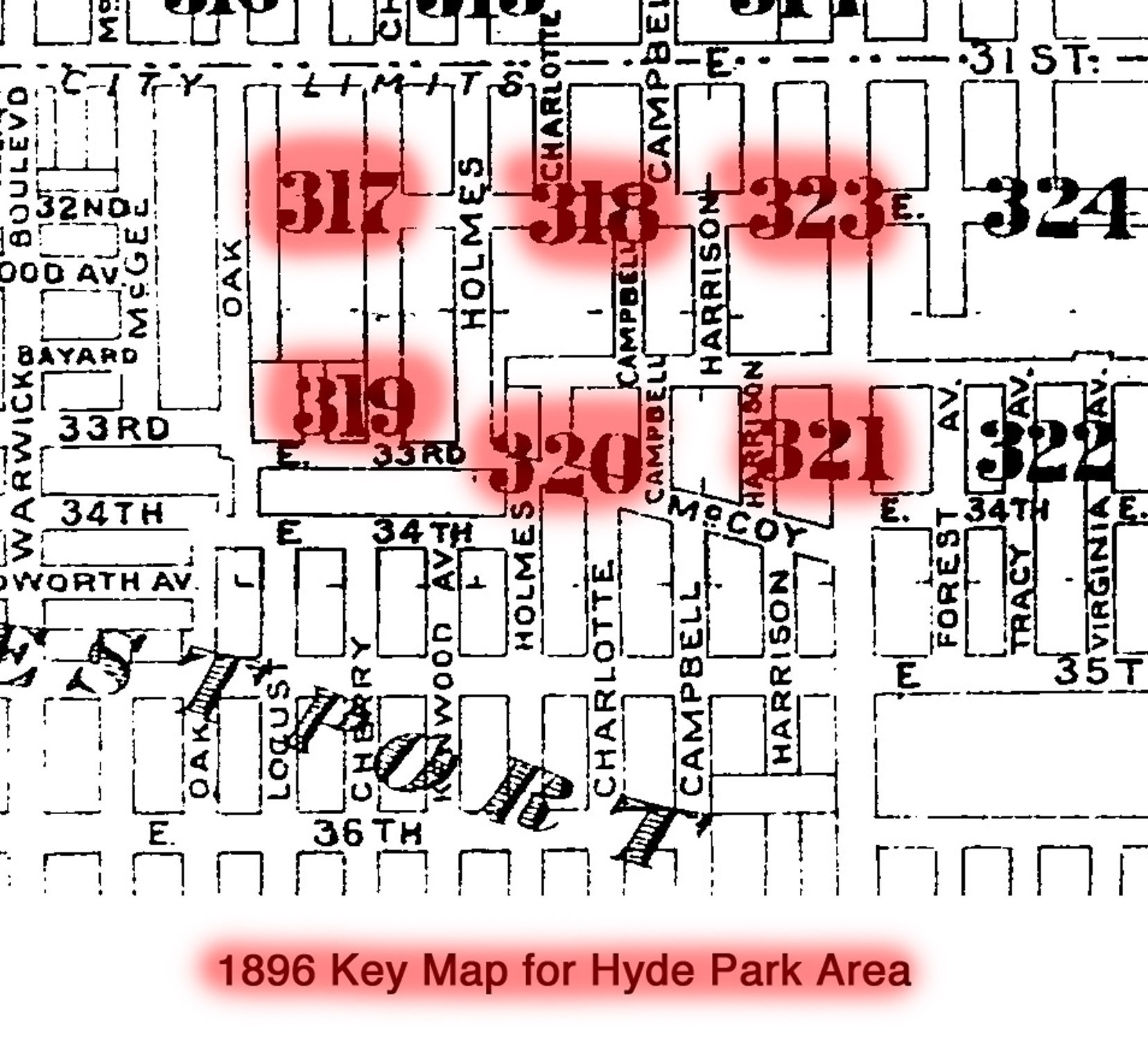
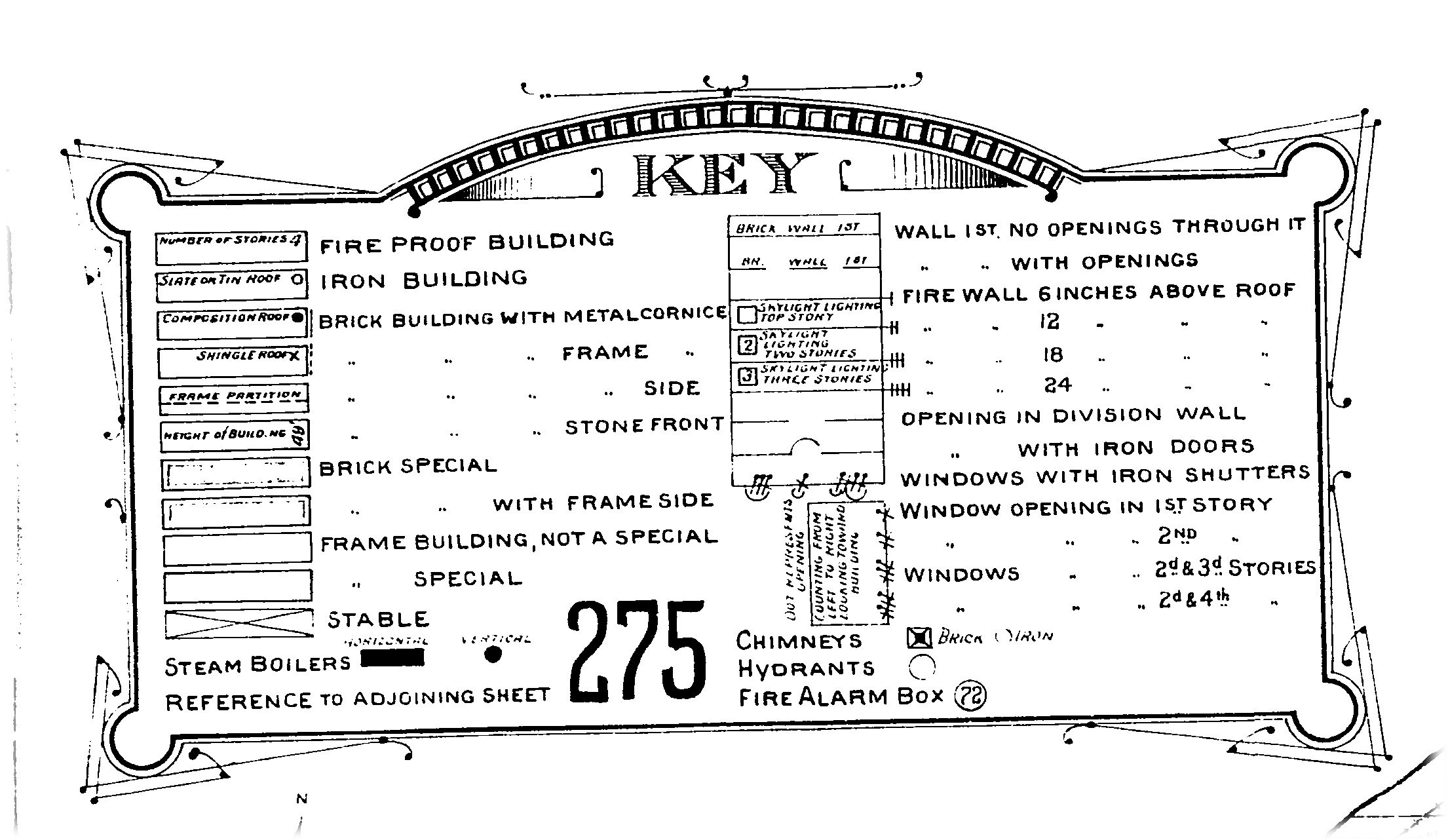
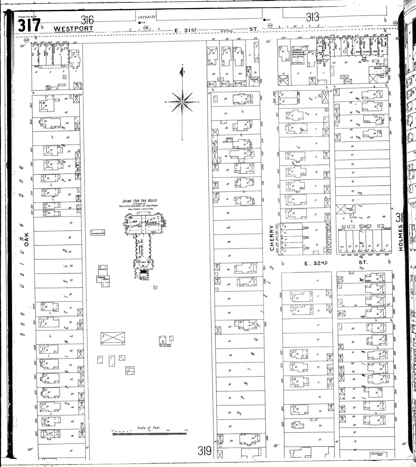
Plate 317 — Oak to Holmes - 31st St is north boundary
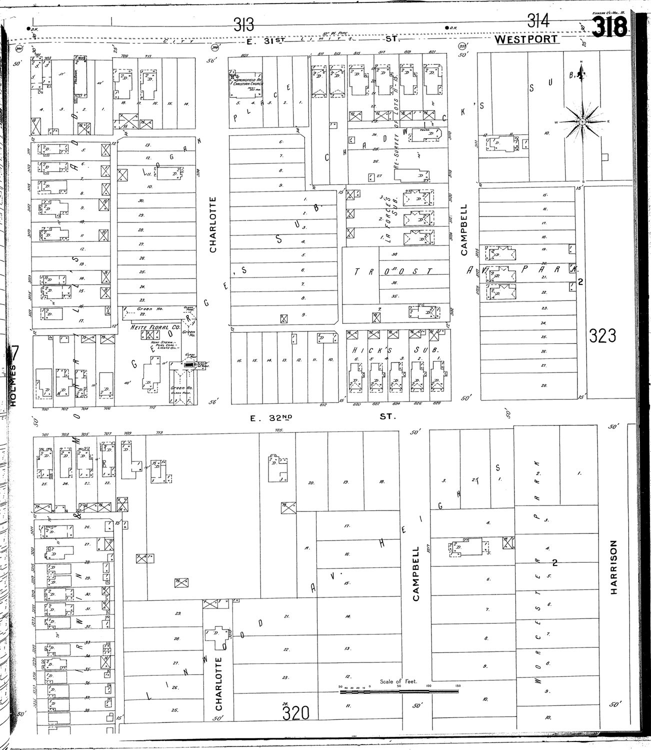
Plate 318 — Holmes to Harrison - 31st St. is north boundary
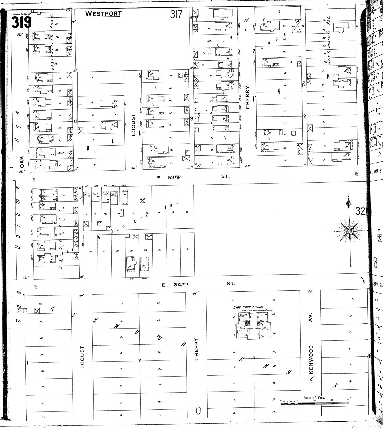
Plate 319 — Oak to Holmes - south of mid-block of 32nd St
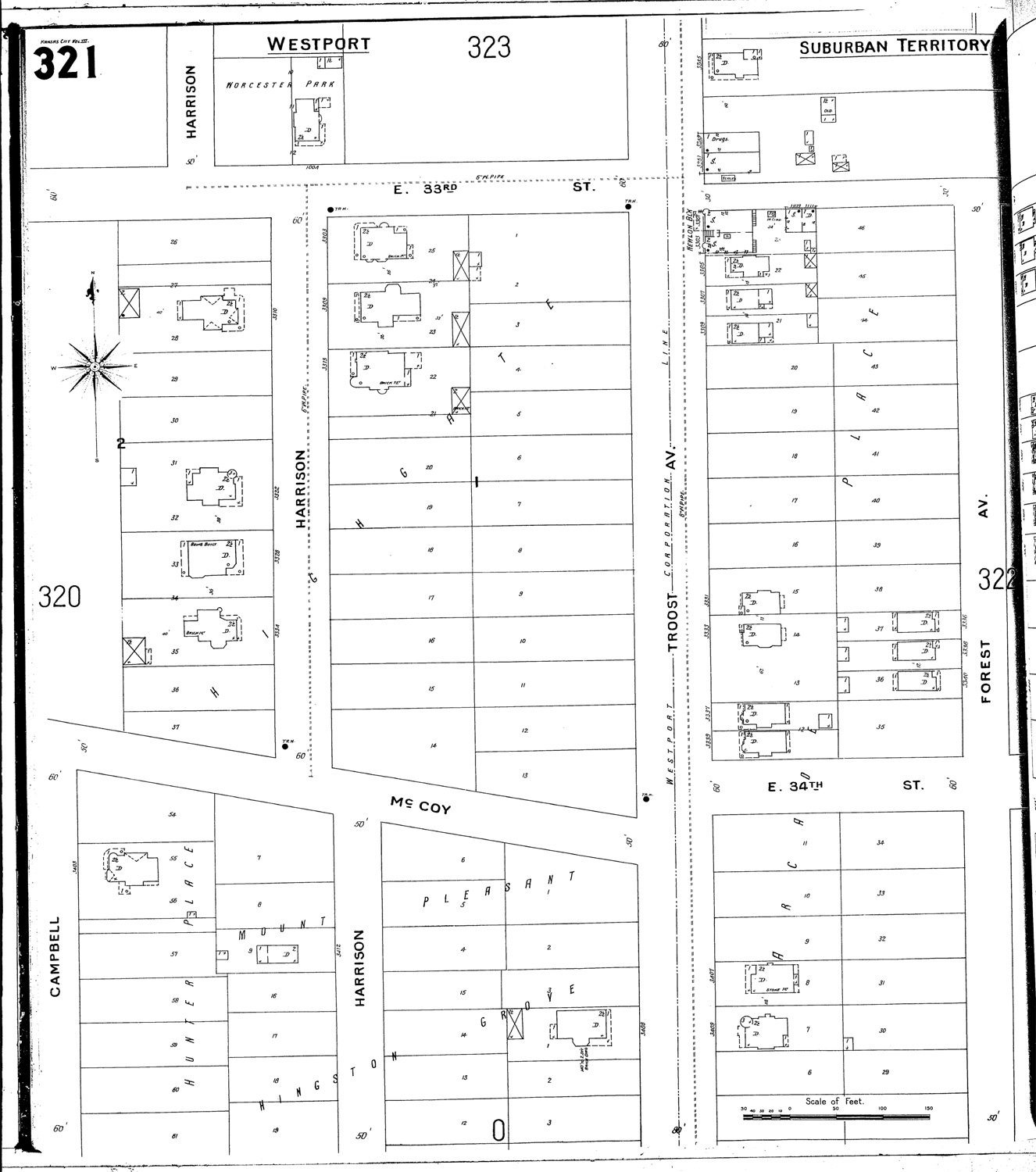
Plate 321 — Harrison to Troost - just north of 33rd St to almost Armour
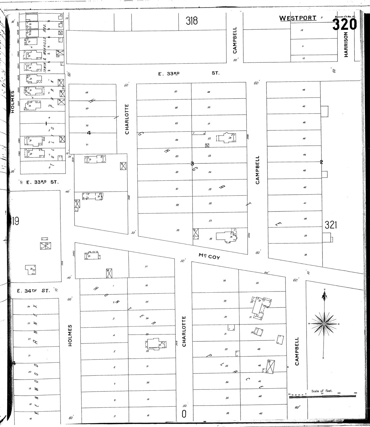
Plate 320 — Holmes to Campbell - just north of 33rd to almost Armour.
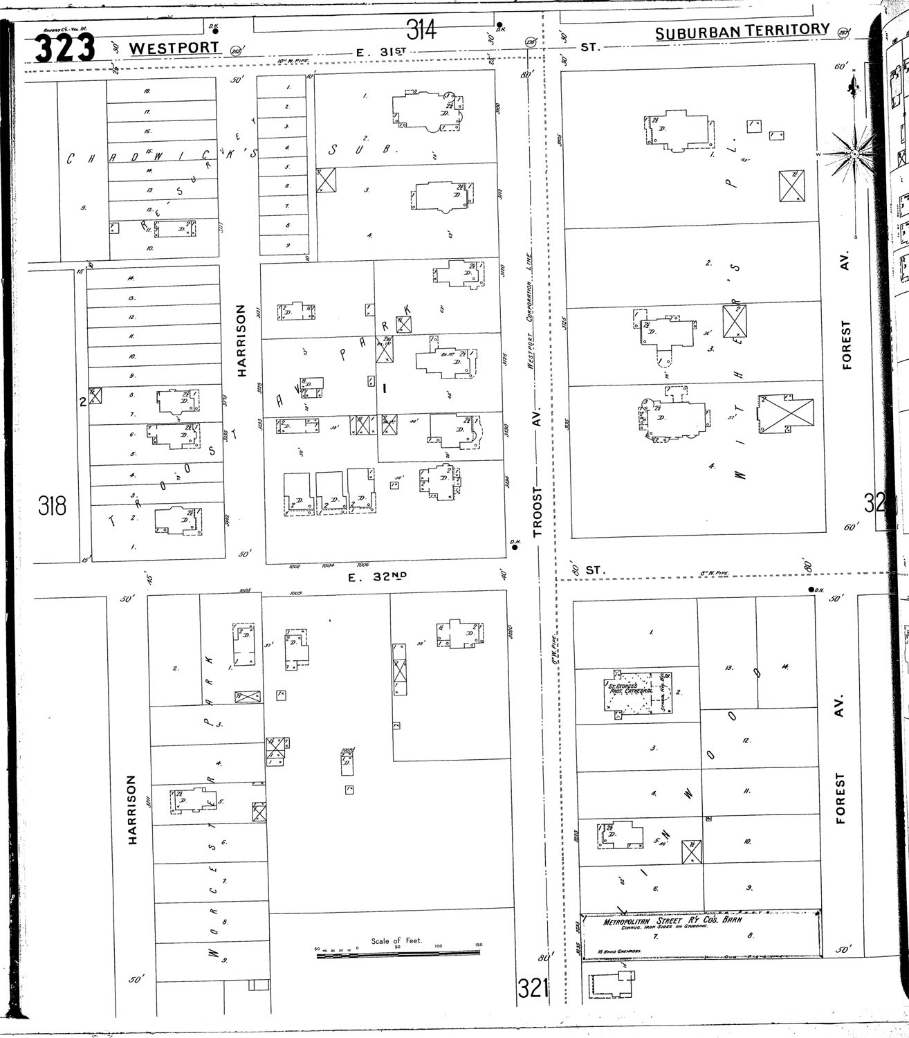
Plate 323 - Harrison to Troost - 31st St north boundary

Future Hyde Park neighborhood - Plates 317, 318, 319, 320, 321, & 323