Historic Maps
1909 Sanborn Fire Insurance Maps, Kansas City, Missouri
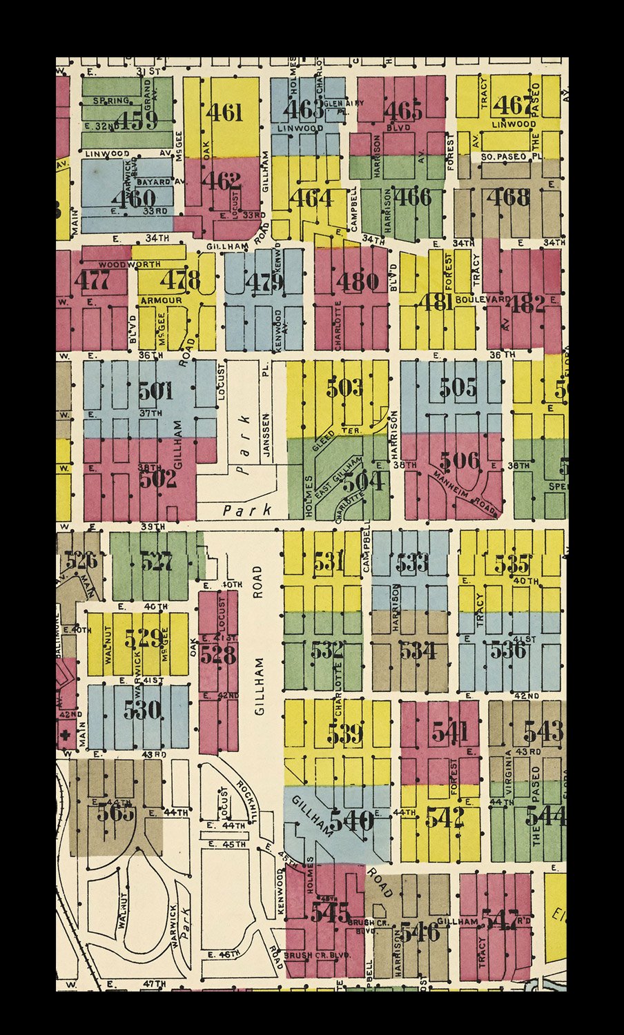
The collection of Kansas City Sanborn Fire Insurance maps in the Missouri Valley Special Collections of the Kansas City Public Library consists of over 1200 individual pages. The large-scale maps provide an invaluable resource for historians, genealogists, geographers, students, environmentalists, and others researching buildings, neighborhoods, and the people who lived and worked in them.
Details on the maps include building footprints and numbers (addresses), street names and elevations, construction material, number of stories, and features like hydrants, fire alarms, and water mains. The locations of underground gasoline or oil tanks and water pipes are also indicated. The maps show rivers, railroad tracks, bridges, and types of buildings, like greenhouses, theaters, stables, etc. They identify businesses, schools, churches, hospitals, and other buildings by name.
The Missouri Valley Special Collections has 19 bound volumes of Kansas City Sanborn maps, which have been digitized, and some Kansas City volumes and selected Missouri cities on microfilm. Additional Kansas City volumes and volumes for other Missouri and Kansas cities can be accessed through the Fire Insurance Maps Online (FIMo) database. You will need a current KCPL card and PIN to access FIMo from home.
For your convenience the Sanborn plates that contain the Hyde Park neighborhood properties have been collected in the
To assist with identifying locations, the Hyde Park plates have also been grouped by east-west streets from 31st to 47th streets below.

