Historic Maps
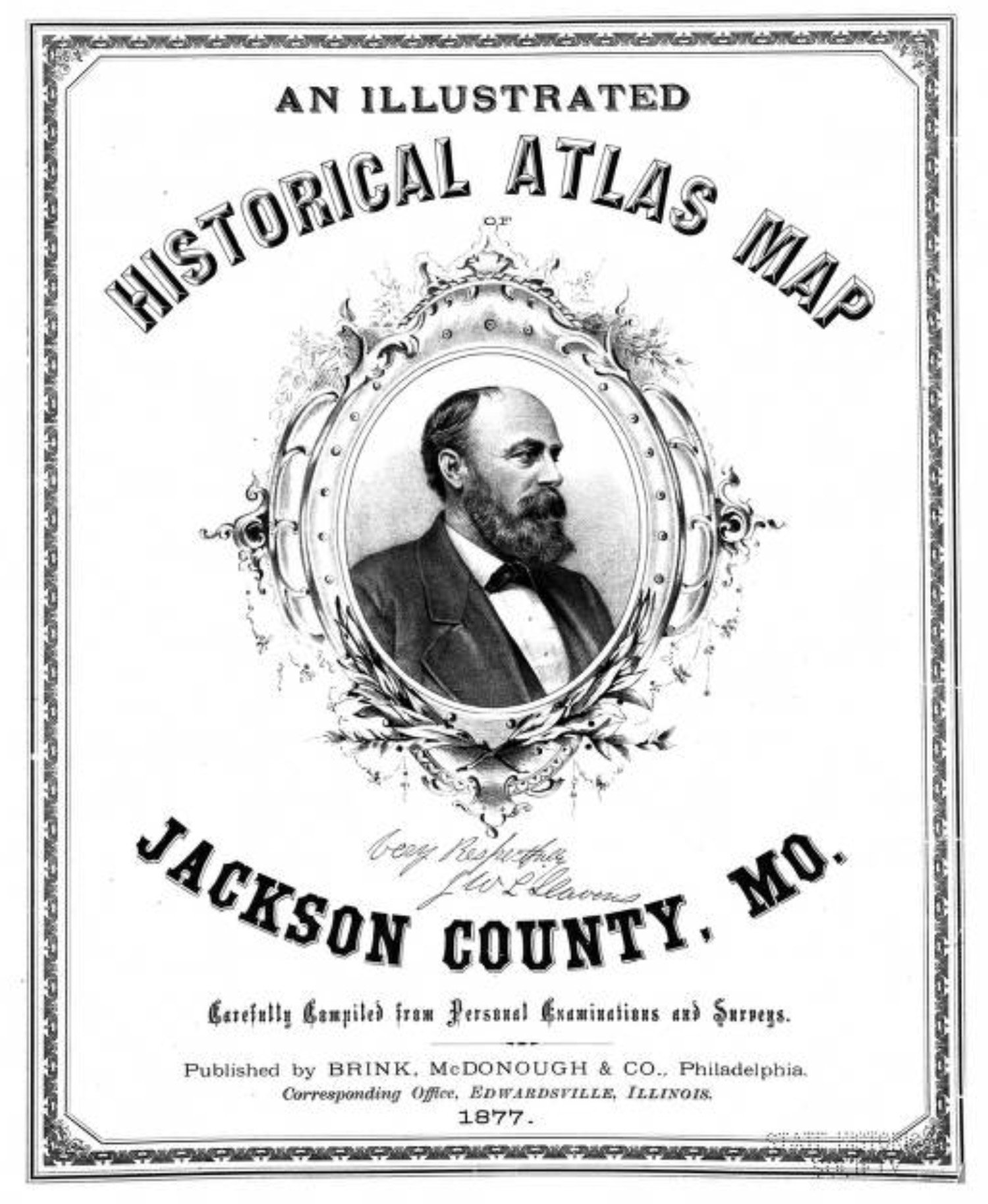
An illustrated historical atlas map, Jackson County, Mo., 1877.
Publisher: Philadelphia, Pa.: BRINK, McDONOUGH & CO., corresponding office, Edwardsville, Illinois, 1877
Source: SHSMO The State Historical Society of Missouri, Digital Collections
Rights: Public Domain
1877 Atlas
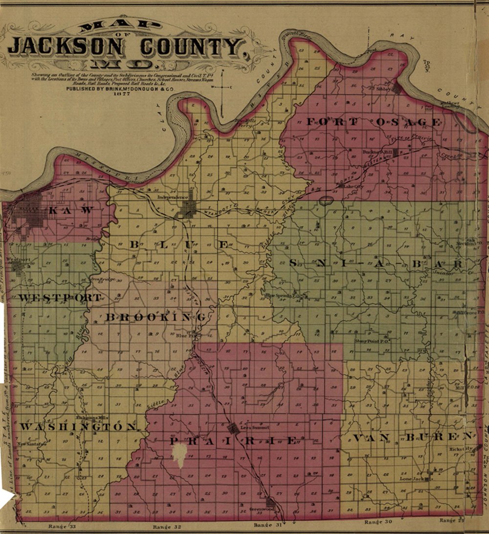
Map of Jackson County, MO — Townships and Ranges
History of Jackson County — Mormon Imbroglio, The Civil War, General Order No. 11 and Kansas City — page 14
History of Jackson County — Trade of Kansas City, Independence, Biographies of Earl Settlers, History of Townships including Westport — page 15
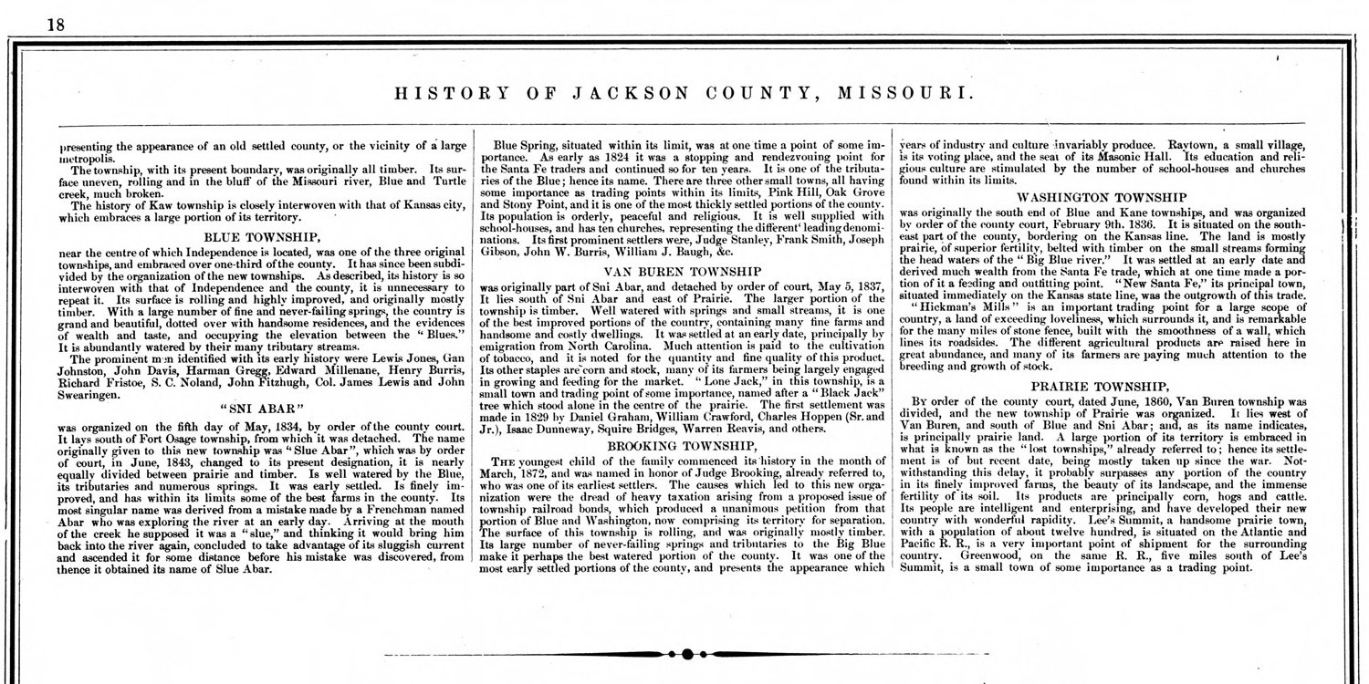
History of Jackson County — various Townships — page 18
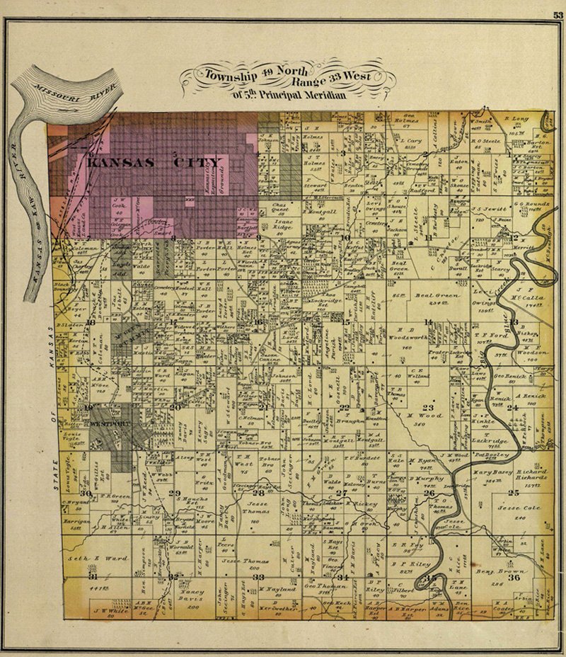
Township 49 North Range 33 West — Includes Westport and future Hyde Park neighborhood.
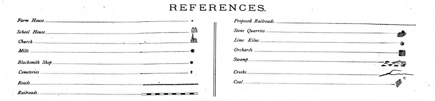
Atlas References — Type of Structures, Roads, Railroads, Cemeteries, Quarries, Orchards, etc.
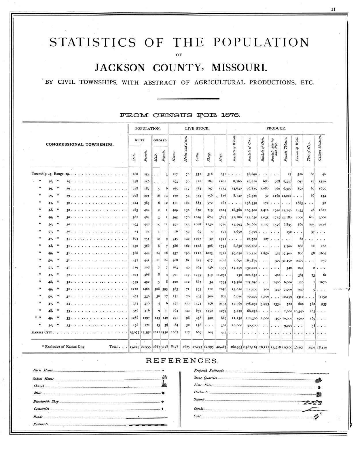
Statistics of the Population by Civil Townships with Abstract of Agricultural Productions, Etc. from 1876 Census.
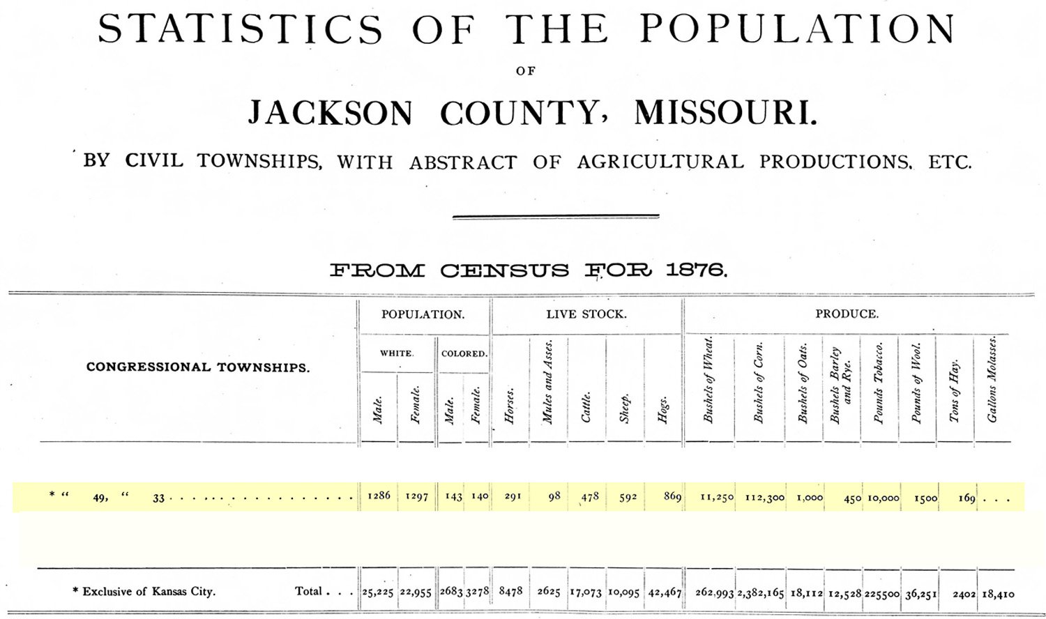
Statistics of the Population for Township 49-Range 33.
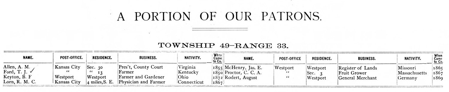
Portion of the Patrons in Township 49-Range 33.

Zoomed in image of Westport and the future Hyde Park neighborhood.
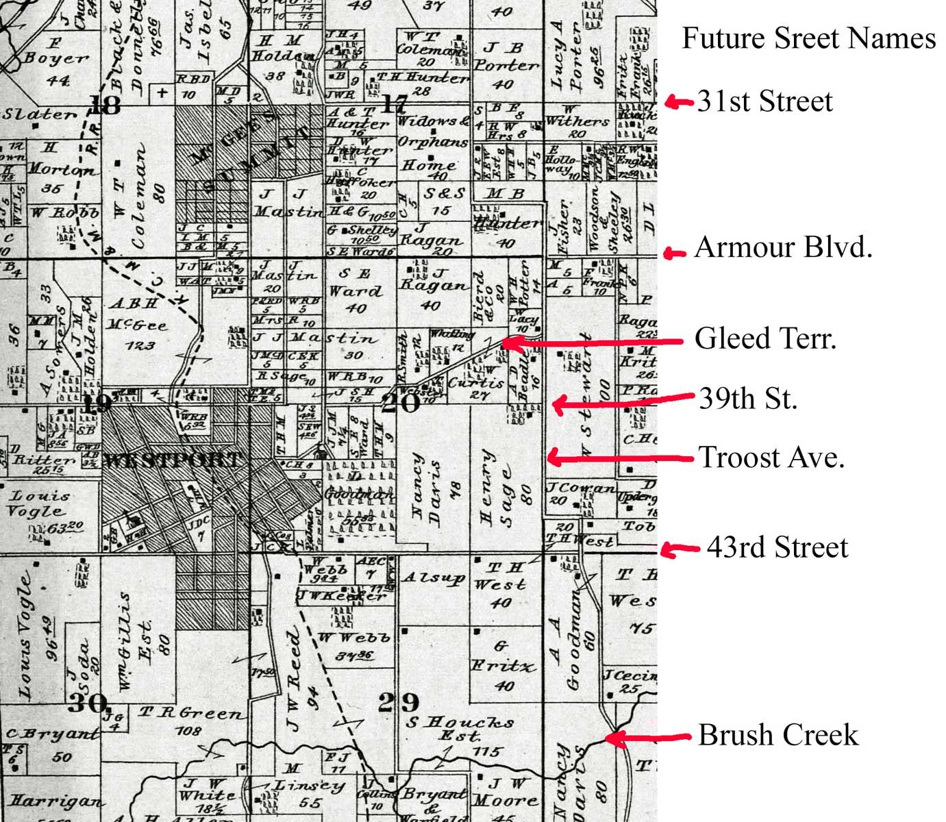
Identification of future Hyde Park neighborhood streets.